Showing posts with label weekend trips. Show all posts

Monday, 27 July 2015

Size isn’t everything

I’ve been asked how I manage to use a day pack for my weekend – and usually longer – backpacking trips.

A few years back my rucksack was a huge 65l plus bag – a Lowe Alpine one. It must have weighed a couple of kilo’s maybe more if I’m honest but I never put it on the scales. It did the job and I was able to get all my stuff in it including a rope, harness, rack and rock boots. With a crag sack strapped on the side I was all set up for a weekend of time outdoors.

At that time my camping stuff was ‘lightweight’ the tent was a two person Robert Saunders one with a huge porch and my stove was a trusty Trangia, and I carried the meths in a thirty year old one litre Sigg fuel bottle.

The first change came when I gave up the climbing part of the weekends away. That reduced the weight and bulk considerably, and meant that those 65l were no longer required.  Although I still found that I could fill the space, and frequently did. And this lead me to see that, with the help of Derrick Booth’s The Backpackers Handbook, if I got a smaller bag I wouldn’t have the space to fit loads of stuff in. I started to focus on what I packed and what I used with the three pile trick. After each outing I’d rank the items I used more than once, just once, and never. And found that the items in the never category were always stuff that I put in ‘just in case’ and I had the room for.  I also started looking at/and replacing items of kit. The first thing that went was the two person tent, I invested in a smaller, lighter weight one person shelter. Then the Trangia was replaced by a simple pot and cartridge gas stove, again lighter and less bulky. The synthetic sleeping bag was replaced by a warmer, lighter, less bulky down one.

The rucksack went from 65l to 55l, and again from 55l to 40l as I reduced the number of items, along with acquiring lighter and less bulky kit.  Some of the items I carry have more than one use, the tent peg trowel is a prime example, it hasn’t happened yet but I’ve not needed to dig a cat hole when my shelter is pitched. Shelters that pitch with trekking poles is another example.
The weight of the kit has dramatically reduced – initially I’d be shouldering over 15kg of stuff now my average is circa 5kg (excluding the climbing kit, obviously). And the weight reduction wasn’t just with the kit on my back, my heavy leather walking boots went to lighter fabric ones, and finally to trainers weighing just 330g a shoe.

I use an Excel spreadsheet to compile the kit that I’m planning to use, this keeps me disciplined as to what goes in the bag and ensures that nothing is forgotten. I also use it to tailor the kit to the trip – time of year, terrain, environment, etc. Experience counts for a lot too – knowing what you need against what you might come across is learnt from getting out there and doing it.

It also comes down to personal preference, and this is the deal breaker – there are those that won’t feel comfortable about leaving home without something or other, usually lots of somethings or others. If you feel the kit you pack needs a backup then pack something that works and won’t let you down. (If you can’t leave the house without a secondary stove packed because you’re paranoid about the primary one failing then you need help of another kind.)

Despite all this reduction in weight and bulk comfort doesn’t suffer, my kit it will keep me warm and dry, and I’ll get a comfortable night’s sleep. I could leave the stove out on summer trips but I like a hot drink in the morning – that’s my personal preference. It’s possible for me to reduce the load further but I’m happy with what I pack and carry. For now.

Friday, 19 June 2015

gsi cascadian cup


Most of my canteen set ups are based around the principle that you eat and drink out of the same receptacle – a pot like the Snow Peak 600 or the Alpkit Mytimug. Whilst this is a great way of saving weight and the double usage that all lightweight backpackers like to incorporate into their kit lists it does have it’s limitations. After all you have to eat your food first and then have your drink or vice versa, unless of course that drink comes in a hip flask or wine bottle in which case it’s just a quick neck in between mouthfuls.

On occasions I like the idea of having something handy for having a brew with the food, and swinging out of wine bottle, whilst effective, is a bit uncouth. And on other occasions, like when I use a cook system that doesn’t lend itself to the pot being used as a mug, such as with my Bush Buddy set up, a dedicated mug or cup is needed. 

The classic was the plastic one pint plastic mug which is what the Snow Peak/Alpkit set ups base themselves around but that volume isn’t always needed as I’m not cooking with it just having a drink. And the GSI Cascadian cup at 450ml is ideal – big enough for a brew but small enough to be packable. The mug has graduations on the inside and the handle has a hole punched into it presumably for those that want to hang it off their backpack. I may take a saw to the handle as I’m not convinced I need it, and that would save some grams despite the weigh saving hole already drilled in it!  The cup is tapered but isn’t that tall so I’ve not noticed any stability issues with it. They come in a range of colours, and for the gram counters out there my one weighs in at 53g.

Friday, 29 May 2015

bikepacking - laleham try out

Overnight spot.

The plan was a simple peddle along the National Cycle Network Route 4 – The Thames Valley Cycle Way – west. I knew that there was a campsite the other side of Shepperton and trains stations along the way should I need to bail. The distance to the campsite was about 15 miles so not a lengthy or arduous run as there are only a few bumps and lumps on the way where the route leaves the river.

The try out was a success and I’m planning the next leg of the route that I’ll do in the next few weeks.

The biggest lesson learnt and one of the reasons for a trial run was to get an idea of timing and distance that could be achieved. I set my cadence to that of my usual walking pace and using my old Garmin Geko 201 GPS I was able to gather data on my average speed. This happened to be 7.5 mph, which is three times my average walking speed. This meant that whilst on foot I’d cover 15 miles in a day, by bike that would equate to 45 miles. I now have a benchmark to work with when planning future trips.

Bikepacking rig - front view.

I’ll review the panniers, bar bag and another bit of new kit that I used on the trip in other posts. I didn’t get around to pitching my shelter using the bike as planned as you can see from the pictures that there was a convenient Birch tree for that job. I wasn’t entirely happy with the fact that the bike was out of view but it was secure.

Bikepacking rig - rear view.

I modified my kit list slightly to give me weights of the kit units – shelter, sleeping, cooking, spare clothes, food, and so on – so that I could evenly distribute the weight between the panniers. And as it happened the units balanced themselves out  reasonably well but didn't go as far as checking the weight on the bathroom scales! The panniers coped with the volume of kit, as expected, with room for more if required. If I wanted or needed to take more or create space in the bags each bag has a pair of D rings on the top so stuff could be lashed on top. The seat post bag held the tools, spare inner, etc. with the bar bag holding wallet, keys, phone, camera, jelly babies and insulin kit. I can't see me needing anything else to carry kit in other than another bottle cage for carrying a bigger fuel bottle for longer trips. Apart from that it was just the same as any other hike.

Monday, 29 November 2010

chilterns, walk for wildlife part two

P1010799Still some colour on the the trees

Saturday morning started with a lot of talk about gear. I had packed the Scarp1, and was kept busy answering a string of questions about the tent. This didn’t matter too much because the day’s mileage wasn’t going to be excessive, and we were expecting a few more to turn up. I also had a chance to chat with Grant about his Big Agnes bivi bag and Terra Nova tarp combo. The wind had given his set up a battering and we chatted about the ways that tarps can be pitched to withstand the elements. In this case the tarp wasn’t big enough to be pitched in my favoured bad weather configuration – the cave or pyramid. Not that it was crucial, as the Big Agnes he was using gave full protection to him and his kit.

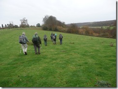
It became clear that once we started to break camp, that black and grease Golite rucksacks were the most popular by far. In fact there were only two rucksacks that weren’t, out of a group of about twenty people.

P1010798

Spot the Golite rucksack...

The Walk for Wildlife weekend is unique. The Warburg Nature Reserve allows the BPC to stay (exclusive to the club) and each attendee makes a donation towards the reserve. Better yet Anne has a sponsor who matches pound for pound what she raises.

And it was towards Warburg we walked. The previous week’s windy weather had stripped much of the leaves from the beech trees that the Chilterns are known for but there was still a burnished colour to the hills. The Chilterns are also known for Red Kites that were re-introduced very successfully here about twenty or so years ago. We hadn’t left the campsite when one of these most graceful creatures circled above our heads.

The route was a pleasant ramble through woodland and up and down hill, with the occasional trot along a valley. And there were plenty of Kites to see along the way.

Arriving late afternoon we found spots to pitch our tents between the trees. With foresight I could have packed my tarp and hammock instead of the Scarp1, next time for them then.

The quiet magic of the Reserve was shattered by the solitary chatter of someone’s radio, so I pointed out that we were on a nature reserve and myself and others wanted to enjoy the dusk as nature intended. With the radio off I cooked supper listening to robins, and then the owls as the light faded.

The nearest pub was two miles away but as I was feeling fit the four mile round trip didn’t deter. Besides what else was I going to do with the rest of the evening? So a bunch of us set off on mass, and returned a couple of hours later. After having convinced the locals that we weren’t mad for camping out at this time of year; it was for charity see.

The night passed with a sweeping soundtrack of foxes, owls, pheasants and other creatures calling out. At one point I had a dream that I was struggling to hang my food from a tree in a bear bag whilst the wildlife circled my tent.

I’d learnt that the train service that I came up on was being replaced with buses. So being close to Henley on Thames I checked whether the service via Twyford to Reading, and back to Richmond from there was running. I was in luck, so Sunday morning I bailed out along the Oxfordshire Way to Henley; a stroke of luck. As I headed along the way I got offered my second lift of the weekend, so thanks to Roger I was able to catch the first train out of Henley. And I got back to Richmond before lunch.

Friday, 19 November 2010

chilterns, walk for wildlife part one

P1010803 The Oxfordshire Way

Friday morning, 10.30

“Jane has sent me an email about a trip to the Chilterns, shall we go?” I asked. “I can’t I’ve got 100 hours of reading to do… for this essay I’ve got to get in before Christmas. Why don’t you go on your own if you want to..”

11.00

Kit compiled. and I’m in the kitchen sorting food, needed a few more cereal bars but otherwise I was ready to stroll.

12.00

I’ve had lunch and I said my goodbyes, and was on my way to Marylebone to catch the 14.23 to Saunderton in the Chilterns.

14.30

Arrive Marylebone… the next train was at 15.23 so I took a train to High Wycombe having been told that there was a bus to Radnage from there.

15.20

Found bus station in High Wycombe and discovered that bus goes at 17.40. I returned to the rail station to catch the train to Saunderton, that was due in at 16.07.

16.15

I set off from the station and headed across fields to find the village. The weather had closed in and a drenching drizzle accompanied me all the way. Low cloud meant that it was getting dark earlier than it was meant to, so the head torch I’d dug out of my bag whilst on the train was put on. Despite the weather and the lack of light my navigation was spot on. Until, that was, I reached the end of a single track road and spotted a sign post that stated, Radnage 1/2 mile. I checked the map and the road did seem to lead to the village. After about twenty minutes there was no sign of the village, and the map didn’t seem to match what I could make out as I went along; buildings and road junctions that shouldn’t have been there. Whilst re-checking the map a white van pulled up along side and the driver asked whether I was looking for the Crown. This took me aback but I said, “yes”. “Ah,” he said,”Are you meeting some people there?” Again on the back foot, I told him I was as it was a club trip. He told me I was heading in the wrong direction and that the sign post at the single track had been twisted to point in the wrong way! He offered, and I took a lift from him. On the way to the pub he explained he’d had a chat with those in the pub and having been told that others were on the way he put two and two together when he saw me. American backpackers would call that trail magic I guess. Anyway I was due a break having just missed the train earlier.

18.00

In the Crown I caught up with Anne and Chris, had a drink and met some club members that I’d not met before. It also gave me the opportunity to dry out and wait for the rain to stop before heading to the camp site to pitch my tent and have supper.

19.30

I was back in the pub, obviously…

Tuesday, 16 November 2010

buxton to roaches

P1010778 The Dane Valley

This has been an annual trip of mine for the last few years. The drive up to Buxton took longer than it should have done, due to several sets of road works, but we still managed to get there before dark, which was what we were aiming to do.

With spectacular timing the rain started to lash down as I stepped out of the car, driven by gusts of high wind. The campsite was already sodden so I squished about looking for a level and least damp spot on which to pitch the tent.

With the tent up I started to blow up my NeoAir, back from the car with her rucksack Penny asked whether I’d packed her Thermarest… Back into the car she drove into Buxton to arrive five minutes after Jo Royle’s had shut. Time to improvise. Wasting no time she raided the local supermarket and grabbed half a dozen corrugated cardboard boxes.

Back at the campsite I made another uncomfortable discovery whilst kneeling in the tent the groundsheet started to seep. Not good.

The tent was taking a hammering from the wind which had changed direction in the twenty minutes since I pitched it. So out I got and repositioned it, reset the guys to the rear of the tent, used my trekking poles as extra pegs, and dug my tent peg toilet trowel in as another anchor for good measure.

The rest of the evening passed without further incident. Apart from the minor fact that my Petzl e*lite was putting out as much light as a burnt out tea light. I was reluctant to use the spares in case I needed them for my blood monitoring machine.

The missing mat meant a change of plan for the morning so along with Geoff, who’s encyclopaedic knowledge of the local bus routes saved the weekend, we walked into Buxton and went to the gear shop to buy a CFC mat. I tried to convince Penny that she needed a NeoAir but given she can get a good night’s sleep on cardboard the expense didn’t seem worth it.

With a mat and batteries bought we had enough time to enjoy a proper coffee before catching the bus to the Cat and Fiddle. This turned out to be a better way of starting the walk as we missed the bitty circumnavigation of Buxton, stepping off the bus straight on to a good path to Three Shire’s Heads.

P1010777 The path to Three Shire’s Heads

The weather was dry but drafty however we soon lost the breeze once we descended into the Dane valley proper. We arrived at Three Shire’s Heads in time for lunch, and in time to meet Christine Roche who had planned to find us there. This is a great picnic spot and, due to the good weather, was the busiest I’ve ever seen it. As Christine was only about for the afternoon she accompanied part of the way until having to return by another route back to her car. She was then going to meet us at the Roaches Tea Room, everyone who knows her will know of her love of tea and cake! Gradbach Youth Hostel was closed denying us a chance for an early breather so we pressed on, taking a more direct route thus missing out Lud’s Church.

P1010782 Autumnal colours

At  Roach End Geoff knee had started to give him grief so he opted to take the road to the tea house, whereas Penny and I climbed up to the Roaches Skyline. We followed the gritstone edge along before finally dropping behind Hen Cloud before finding the road, and ultimately the tea shop where we found Geoff and Christine tucking into tea and cake – obviously!

We pitched our tents with setting sun lighting up the evening sky. And I popped down to the Rock Inn for something stronger than tea to wash supper down with.

The Sunday dawned cold and claggy. Geoff’s knee had seized up and he wasn’t up to returning to Buxton on foot. Fortunately his local bus timetable knowledge saved the weekend for the second time. So Penny and I escorted him down to the bus stop to ensure he got back to our starting point without incident.

Wednesday, 26 May 2010

west highland way - day one

Is this the start?

A short notice smash and grab affair that was worth the miserable return overnight coach journey from Glasgow.

We weren't a mile down the way when we met a couple of women heading towards us. "Are you doing the West Highland Way?", they asked. "Yes!", was our reply. "Good, because we're lost..."

Having set off earlier that morning with an A4 laminated map they had somehow managed not to follow the Way. As we headed along it was very apparent that they were going to have trouble navigating their way to Fort William. Several times they asked, "How did you know to turn here?", to which our reply was always, "See that signpost over there..."

We escorted them as far as the distillery where we turned off for a quick supply visit. Back on the Way we made good progress getting to East Drumquhassle but it was too early to stop. A quick check on the campsite reminded me that a fiver for a night spent on something as lumpy and sloping as that would be a waste of a good drinking voucher. A terse exchange with the campsite owner over 500ml of water did nothing to change my mind. I didn't realise that water was such a precious commodity north of the border...

In the Garadhban Forest Liam and I stopped for a brew and chatted with various wayfarers as they passed. The weather had been good all day and despite the forecast for showers they had been few and not particularly bad but as the afternoon progressed however they became more frequent and more intense. Once out of the forest we could see that the weather was closing in so a hunt for a spot was on; the official 'wild' camp spot on the edge of the forest had long vanished with the trees. A quick look at the map revealed a couple of potential sites near the Burn of Mar at the 17.5 mile mark. A fairly flattish spot with a view of Conic Hill and Loch Lomond was found close enough to the Burn for ease of water supply but far enough away to keep the babbling of the burn to a hushed silence.

Conic Hill, the fault line, and Loch Lomond

At this point I was pleased at how easy the Scarp1 is to pitch, in very little time and with no fuss I was happily ensconced in my home for the night with a pot on my stove heating water for some soup. Outside I heard Liam cursing as he fiddled with the many guys and pegs of his Jetpacker.

A few words on the Scarp1. Apart from ease of pitching, which at the end of a long day when you're tired, hungry, suffering from hypoglycemia, and getting rained upon, is worth more than a multi million winning lottery ticket (well sort of); there's the space. The second porch took the rucksack, damp waterproofs and trainers. And in the other I had space to cook, although I pegged the inner back to create more headroom above the stove. Internally there was space at either end to fit the rest of the kit that I was carrying, which wasn't that much given I was using the Golite Peak.

With supper eaten, I settled back and sent messages home. As the light began to fade, I started a sudoku puzzle, had a dram or two of whiskey, and with the puzzle half done I drifted off to sleep...

Monday, 17 May 2010

the thames path - home to windsor

Seething Wells

This was meant to be our last section hike of the North Downs Way between Otford and Rochester. However an early panic and flapping session involving a set of missing car keys (and not for the first time this week I might add!) meant a swift change of plan.

Liam and Tina headed to ours for an amble along the Thames westward towards Windsor. I'm not sure how far I can get with boasting about living less than 500m from a National Trail, if I lived in Edale or Twice Brewed it would be another matter. That may be but the route offers a wide breadth of changing scenery from the City landscape of London to the rolling hills of the Cotswolds. Oh and it's flat, mostly.

The trip was intended to introduce Tina to the backpacking experience. An oversight on my part scrabbling to approximate the distance meant Saturday's mileage was a little understated; 14 miles and not the 10 miles that I'd figured. The Thames wiggles, twists and turns a fair amount. And as the trail has to depart the river in places it makes counting grid squares to estimate the distance pointless.

Tina, Charlie and Liam

What amazed me was the diversity of buildings along this stretch of the river. It's a real mish- mash; prefabs, cottages, mansion houses, bungalows, and the odd palace. And the condition of these buildings were as varied; collapsed, ramshackled and pristine in unequal measure. There are several eyots along this stretch too, some reached by footbridge others seemingly by the use of oars or outboard motor.

We stopped at a river side pub near Sunbury Lock for refreshments, non alcoholic in case anyone was wondering. I redeemed myself in his eyes later by jogging into Shepperton to pick up a bottle of merlot to wash supper down. This foresight was swiftly banished when on the way into the campsite at Laleham we passed a garage that sold booze that would have saved me carrying the bottle and it's contents those last few miles. And much to Tina's delight I whipped out a mini can of rum and coke for her to celebrate her days effort. (There might have been a touch of guilt for buggering up the first days mileage in that process).


I got a good night's sleep and only woke once due to falling off to sleep without putting my beanie on. I woke early to the sound of birdsong; blackbirds, song thrush, robin and chiffchaff, were joined by tits, and a solitary woodpecker. I love camping at this time of year; spring birdsong as an alarm clock is a real pleasure to wake up to.

The mileage for the second day was much shorter which was a relief for the foot weary. My knee was fine but my overlapping toes were a bit sore. The weather wasn't as good, overcast and windier than the previous. The Montane windshirts that Penny and I had proving yet again that they are worth their minuscule weight and pack size.

On approaching Staines we were surprised how up market the place was, no sign of the Staines Massive. And I can state that I didn't see, one, let alone a group of hoodies. However heading out the other side and you get a different picture, the south bank of the river is heavily industrialised. And from the condition of some of the units not particularly successful businesses occupied them either. We swiftly left the crumbling industrial units behind, and the valley opened up as we entered Runnymede. Past Old Windsor and Ham Island where there's a short bit of canal that's been cut to take the sting out of the loop around the island. Just before Albert Bridge we spotted two red kites wheeling and hovering in the wind.

At Datchet we made an executive decision to grab the train from there rather than struggle with the crowds that we'd meet in Windsor itself. It goes without stating that what took a day and half to walk was covered by a 25 minute train journey.

Tuesday, 11 May 2010

tgo challenge 2010 - reprive

I pulled out of the Challenge a few weeks back as I wasn't going to be able to take the required amount of time off to take part.

The good news is that I've got Thursday and Friday off, so that I can use my ticket. The plan is to walk a bit of the West Highland Way, although I've already done this route, and may be bag Ben Lomond.

The thing about this trip is that the last time I ventured out along the WHW, only a couple of years back, I did it in boots and carrying a Gregory Z55 rucksack. This time I'll be wearing my trusty Terrocs and using a Golite Peak; a 40l 'day' pack! My kit has changed and evolved but the most important thing is the knowledge that I've gained since then. As someone once put it, 'The more you know, the less you carry.'

I wonder who I'll bump into at the station tomorrow evening?

Sunday, 17 January 2010

buxton to roaches (non) trip report

It may have been a case of being overly ambitious but the weekend didn't pan out like I was hoping. We set off at four thirty Friday afternoon. Not the best time as we'd be hitting the north circular at rush hour. But our reasoning was simple; the earlier you get away the earlier you arrive. This, of course, doesn't account for the pain of sitting in a traffic jam. It took two hours to cover the few miles from our house to the gateway to the north; the M1 at Staples Corner. During those two hours we started to hear an unhealthy rattling from the underside of the car. Pulling over at the first (or last, depending on which direction you're travelling in) service station to find that the cage that held the spare tyre had worked loose and the spare was missing! I secured the cage and was confident that this would fix the rattle.

Back on the M1 we crawled along at twenty or so miles an hour accompanied by a slightly differently sounding rattle. About this time Jay called me from Cold Springs Farm with some news. (She had rather sensibly travelled up earlier by train.) We were told not to drive beyond the car park as the car would need a tractor to retrieve it as there was four foot of snow on the campsite! The Farmer had offered them room in the bunk house along with another group who had turned up with the idea of pitching tents. She said that the roads in to Buxton were now passable but thick fog was causing problems. She also asked if we could stop by an off license so that we could make the most of the accommodation with drink and nibbles!

We continued to crawl along the motorway with thick freezing fog now adding to the misery. At Junction eight we pulled off the M1 and re-checked the underside of the car, it seemed the exhaust pipe now swinging in space. It became clear at this point that to continue on would be irresponsible so we re-joined the M1 heading south and for home. I sent messages to Liam and Jay letting them know that we were bailing out. It was disappointing to have to do so, especially as the weekend was one that I suggested, and it was to be Penny's first trip out in months.

Having had a couple of mechanical failures on the old bus over the last few months including the clutch going on Christmas Eve, I think it's time to trade it in for a newer, hopefully, more reliable model.

Friday, 15 January 2010

first trip of the new year

This afternoon Penny and I'll be heading up to Buxton for a weekend of winter backpacking. Surprisingly I won't be testing many of my recent purchases; the Scarp1 and the Golite Peak are both staying at home. Although the Scarp1 has his and hers porches and would sleep two 'adventure racers', as tent manufacturers would have us believe, the extra space of the Helion2 wins. I will get out on a solo trip in a fortnights time to try it out however. The Golite Peak has been my day sack of choice since I got it but the extra capacity of the Talon 44 is needed, not least because of the relative bulk of the Helion2. I think that the Scarp is bulky but that's because I've gotten used to using a single skin shelter. I will be trying out the Golite Adrenaline 20 sleeping bag, it's going to be interesting to see how I make out with the unique zip arrangement.

Wednesday, 11 November 2009

vale of pewsey

“There doesn’t seem to be much of a distance between the two campsites,” Ramblin’ Jay enquired of the BPC new members meet. Which was true but what she didn’t know was this area of Wiltshire is studded with tumuli and other ancient remains that are connected by a network of paths, tracks and trails. Enough to make up several weekends walking in fact.

The weather on the run up to the weekend was poor and I ditched the idea of packing the Bush Buddy as I doubted that I'd find any fuel dry enough to use. Although I did pack the tarp as I’d found a set up that would give the best weather protection from a rectangle of green nylon and a couple of trekking poles.

Tarp pitched at Wilcot

Friday night's pitch was a very sheltered spot and I pitched the tarp facing a wall but I didn’t need the extra coverage. We sat out side watching the stars slowly disappear behind the encroaching cloud until we felt spots of rain that had us diving for cover. The rain was short lived and the cloud passed leaving a clear sky with tumbling temperatures and rivers of condensation running down the tarp. Not that it mattered I was comfortably cocooned in my sleeping/bivi bag combo.

Saturday got off to a leisurely start despite the pre sunrise up farmyard cacophony of cockerels. Introductions and greetings were exchanged over breakfast and coffee. And several ideas for routes were proposed and debated. Two loose groups set off in differing directions with these breaking down into smaller groups as the morning progressed.

On the Wansdyke Path, West Woods

Ramblin’ Jay, Mark, Steve and I splintered from the group we started out with and headed on to pick up the ridge that ran from east to west along the northern edge of the vale. We loped over rolling down land in bright but breezy sunshine, stopping for a break in a small depression on the side of the chalk escarpment. I used the break to eat a home made gluten free pork pie and to flick the remaining moisture off my tarp and into the breeze.

The southern edge of the Marlborough Downs

At Adam's Grave on the Pewsey Downs Nature Reserve we headed south to Honey Street on the Kennet and Avon canal and in doing so the white horse on the hill side revealed itself as we retreated to the pub.

One of the many white horses

At the pub Mark and I discovered that a book we both owned had had a big influence us when we were much younger and was instrumental in getting me backpacking. The book was Derrick Booth’s The Backpackers Handbook. Even more bizarre was the fact that Mark, a fellow blogger, had written about the book and Derrick had contacted him. Here’s Mark’s post on the subject.

From the pub it was a easy ramble along the towpath to Wilcot. The sun was beaming and in the shelter of the vale it was hot enough to strip off the legs and walk in shorts to the campsite. Unlike the previous nights site this was more open and I was a bit concerned about my kit being on view under the tarp. Due to the prevailing wind the open end was facing across the site to the road which didn’t help. I cooked and chatted to others as they floated by and had a snooze before heading to the pub.

The following morning started grey and threatened rain. Ramblin’ Jay and I opted to take what was meant to be the most direct route back to the car. Along the canal, over a bridge and along the White Horse Trail north.

Ramblin 'Jay on the way

Everything was going to plan including the increasing dampness of the day until we headed up on another ridge near Oare and somehow we managed to drift slightly off route going further to the east than we needed to. We handrailed a fence and then a forest enclosure heading north, with the rain and clag reducing visibility and adding to the challenge. All way marking and signs of any footpath vanished so we dropped down across a meadow and located a path running along the edge of another enclosure. At the junction of this path and a track there was a OS map planning application that indicated that we had found our way back to the White Horse Trail and highlighted the dog leg diversion that we’d managed to take in doing so.

Before leaving Wilcot David Topley (the weekend’s organiser) had mentioned that the final leg of the route back to our starting point was through a field of maize that was head high and difficult to pass through. When we arrived at the field and we took one look and didn’t even bother. We circumnavigated the field, which in itself wasn’t without problems as we had several barbed wire fences to get over/under.

An enjoyable weekend where I made some new acquaintances, caught up with some old ones, and tried out some kit.

Monday, 2 November 2009

normal service will be resumed

My blogging has taken the backseat over the last few weeks mostly due to stuff going on in my personal life; Some good things have happened and some not so good ones too.

The shenanigans around the house sale and purchase have finally finished and we have the date of 18th November for the move – hurray!

The ongoing issue around contact with my son is steadily improving and I spent four days with him last week. In the past, any time we had together was always put to good use, going to museums and the alike. So it was a joy just to spend time doing mundane every days things with him that I’ve not had the opportunity to do before. Although this time was nearly hijacked by the very people that are responsible for ensuring that he gets time with me. Go figure.

On the work front, El Bow the Iberian Archer, has paid a visit and I’ll be leaving at the end of this month. Not the best timing. I briefly toyed with the idea of doing the Pennine Way until Dave Mycroft pointed out that even with parts of it paved canoeing across some of the boggy bits (of which there’ll be many more of than say in September) will be required. Unless we get a stunning couple of weeks of deep freeze which is unlikely in this age of global warming.

Despite all this I still managed to fit in some backpacking and I’ve two trips to write up; The Vale of Pewsey BPC meet and the 1066 Country Walk weekend.

I’ve managed to pimp my audio arrangement thanks to some button pushing by Ben, I discovered that that the crossovers on the speakers was between the mid/tweeter units and the bass units. Why have the power amp driving the bass unit when I can harness it’s muscle to drive the mid range and tweeter instead? So I dropped Massive Attack’s Protection in the tray and had a listen to the first minute of the first track. I then powered down, swapped the leads, and replayed the track. The bass was leaner but the detail in the mid and treble was greater, and noticeably so. Sweet.

Thursday, 17 September 2009

carneddau

He did mention that his boots had a Goretex lining whereas my trusty Inov8 Roclite 315 did not. I kind of wished that I put the Seal Skinz in my Talon 44 but as the weather was warm, clear and bright it didn’t matter that my feet stayed damp, sodden in fact, whilst we were away. The upside of having wet feet was that I stayed on them unlike my companion, Liam, who seemed to take great pleasure in diving into marshy bog grass and clumps of star moss at will. I could be mistaken but I thought at the time we were there to brush up on our crossing open country skills for next years TGO challenge not to get some training in for a bog snorkelling competition.

On the subject of the Challenge I was reminded on Friday morning that the dreaded midge loves my blood for breakfast. Liam asked me to stand next to him to distract the blighters whilst he ate his cereal bar, at a far too leisurely pace for my liking.


The great thing about the Carneddau is that, apart from the impromptu bog snorkelling practice opportunities the massif presents, there are fewer people about. Now this might just be down to the fact that everyone apart from us had figured out if you want bug free, firm footed walk you're better off across the A5 on the Glyders. And as we started our jaunt on a week day we only met one other bog trotter all day.

With a few ideas for possible wild camps from him we waded our way up to Gwaun y Garnedd the saddle between Carneddau Llewellyn and Foel Grach. Bog trotting across open countryside and going up hill was slow going and we frequently stopped to look back at the unfolding view. From Foel Grach we continued on to Garnedd Uchaf and then followed the ridge out to Drogsl before heading back to Bera Mawr to find a lumpy pitch large enough for our shelters and a guaranteed uncomfortable nights sleep. With the sun heading home for bed for the night we cooked supper and Liam baked some bannock.

Armed with cameras and mobile phones we squelched our way around to a suitable spot and snapped away as the sun set enjoying our first cloud inversion.

Despite packing my NeoAir the guaranteed uncomfortable night was duly had. The day dawned better than the previous day with more sun and little cloud but I wanted to get full value from the lumpy ground and was slow to rise. I’d used a zip lock washing machine on my socks the evening before and they were almost dry. Obviously they didn’t stay that way for long. Over breakfast we concocted a plan; we’d walk over Drogsl and down into Bethesda for a can of coke before heading back to the car.

Sunday, 6 September 2009

south downs way - winchester to buriton

The best ideas are simple ones. The plan was to take the train to Winchester and start down the the South Downs Way. The Hampshire end has few campsites and, as it is mostly farmland, the opportunities for a discreet wild camp are few and far between. And despite the farming, water is also hard to find. And those cattle troughs I did spot were guarded better than the gold in Fort Knox.


Nevertheless
we were undeterred by this. The section between Winchester and Exton was reminiscent of the first leg of the North Downs Way; flat, sometimes slightly rolling farmland. And the path like other sections is mostly bridleway which made for easy walking. Despite a late start we made good progress and found ourselves in Exton at six just as the pub was opening. We grabbed the now obligatory orange juice and soda, peanuts and crisps and asked about camping. We were in luck, there was a farm nearby that did camping. We grabbed a bottle of wine and headed off to the site. In retrospect we should have taken up the offer to be picked up as the site was about a mile and a half off route and much of that was along a busy B road. Arriving at the farm the site owner explained that the official site was being dug up, but we could pitch our tent in the walled garden where the swimming pool was!


The grass was short and the site level which was a surprise however it was next to the road. The tent was soon up and we made use of the pool side furniture to cook and eat our evening meal. Dark looming cloud and spots of rain had us clearing up and retreating into the tent as night fell. The Wasabi is a great little tent and we were able to pass the time happily finishing off the wine and listening to the rain patter harmlessly on the fly.

The day dawned bright and cool. The sun failed to reach our enclosure and as the rain overnight gave way to clear skies the tent was damp with rain and condensation. After an early breakfast we broke camp and headed back to Exton and picked up the South Downs Way. Despite a good nights sleep - I played the joker and used ear plugs that muffled the traffic on the road - I found it hard going. Initially it was over similar terrain but as the route began to roll higher and higher I found it harder going with no power in my legs. I was also suffering from an excitable tummy. We stopped for a extended break at the top of Old Winchester Hill, an Iron Age Fort.


And it's easy to see why they made this very obvious spot a fort; it has commanding views in all directions. We could easily make out the Isle of Wight. With the sun shining and a good breeze blowing across the top we dried and aired the tent and our sleeping bags; good backpacking housekeeping. I even inflated my NeoAir and took a ten minute snooze in the (vain) hope that it might help. Progress was slow; various detours and switch backs seemed to hinder our advance along this section. We stopped at the Sustainability Centre for a drink and a now frequent visit to the loo for me. Some more road walking lead to the familiar downland ridge walking that the Way is known for. Dropping down from the ridge the route crosses the A3 at gap in the ridge.

At the information centre we grabbed more refreshments and made use of the facilities. Enquiries were made at the desk about camping nearby but we'd past the one farm about a mile and a half back, and off route that were happy to allow backpackers to camp. I wasn't happy about backtracking even less so when we were told that the facilities were minimal and only open when the farm was. Or there was a bus back to Petersfield in less than half an hour from where we could get a train back to Guildford. It was really no choice and we grabbed the bus and was home in little under an hour.

On reflection having a gyppy tummy isn't pleasant, on a trail even less so. Importantly there is the issue of dehydration and, the fact that what you do eat you don't get the full benefit from, will effect your performance even over easy ground.

Tuesday, 18 August 2009

south downs way – lewes to upper beeding

Easy going downland track

We left the car in Kingston near Lewes and after a short, sharp haul up the side of the south downs ridge we were on the Way.

There was a stiff southerly breeze blowing across the ridge and the sky was threatening rain that fortunately failed to materialise. Although my hands became clammy from the moisture laden air. The path is well marked and well worn, and was busy with other walkers and mountain bikers. This section is all bridleway, and much of it wide enough for walkers and bikers to pass easily but some is single track which made for some interesting occasions. Only one twat sliding down a gravel single failing to brake had us jumping out of the way, which spoilt what was up until then, a happy co-existence between us and two wheeled users of the Way.

Jack, or is it Jill Mill?

Rolling down land passed easily under our feet as we headed west. And the views from the whale back ridge north and south were expansive; the south coast and sea on our left, and the Weald and North Downs in the distance on our right.

The National Trails website lists a pub at Pyecombe that has basic camping and this was where we hoped to pitch up. Unfortunately as we got closer to the pub the noise of the road began increase; it became very clear that any hope of a peaceful nights camping wasn’t going to be had. There were a couple of water points ahead and potential wild pitches so we pressed on. The sun was starting to set as we neared the hostel in Truleigh Hill so we knocked on the door to see if they’d let us pitch in the grounds, a gruff voice answered the intercom and told us that they ‘were not operating.’ When asked about alternatives or suggestions we got the brush off. A jarring irony when taken in contrast to the original plaque that stated the YHA mission to provide a welcome to all travellers… At least the tap was working so we filled up and headed back to where we’d seen a potential pitch by the telecom tower. Not the best location, so we dropped down and found a small flattish spot with a bench and a view across the Weald and along the Fulking Escarpment. After a meatball supper and half a bottle of wine we turned in.

Sunset over Truleigh Hill

I woke early and put on a brew. We wasted no time in getting the tent down and the gear stowed away but we lingered on the spot as the sun crept over the downs. Across the Weald pockets of mist and fog covered the land and in the distance a lonely church spire stood as if on an island in a white sea.

Damn fine mug of coffee

By the telecom tower we found that a couple of guys had pitched a tent on the spot that we’d surveyed the evening before, after a brief chat we headed west along the Way stopping at the hostel for water and to dump our rubbish. The route runs on a road from here past Beeding Hill before dropping down a enclosed single track to the road. A couple of early morning mountain bikers pedalled up in low gear past us without incident.

The long way home

Crossing the main road we picked up the Downs Link into Shoreham. I stood on the path, a disused railway line, looking north and thought, just thirty miles along this track was home. But that’s for another day and turned south to Shoreham where we picked up the train back to Lewes.

Tuesday, 7 July 2009

the ridgeway part2

I awoke at 4am and watched the rising sun colour the sky; with a full bladder and still being half asleep it didn’t occur to me to find my camera and capture the moment. And when the sun finally struck the silnylon it began to heat up it was time to rise and have breakfast.

Continuing with my ultra lightweight experiment I dropped the usual dish of muesli for breakfast and went for a couple of cereal bars instead. The thinking behind this was that I’d save the weight of fuel used for heating the milk that I’d eat it with, and that of the milk or milk powder that I would be carrying. And there’s no washing up to be done which is an added bonus. Unfortunately I started to run out of steam with in an hour of starting the walk so some refining of this approach is required (read as need to eat three cereal bars!)

Poppies on field edge

From the campsite we dropped down to Bennett End to pick up Grange Farm Road which we followed until reaching Crowell Wood and despite still being early in the day the shelter of the wood was welcome. Over the other side of Crowell Hill we pulled off the path for a quick breather and the view from the field where we stopped across the Vale of Aylesbury was quite expansive. Dropping down the hill we picked up the Ridgeway Path and followed this north east past the Chinnor chalk pits and onto the Midshires Way at Hempton Wainhill which we followed into Bledlow.

Ridgeway waymark

A lunch stop was taken at the Lions of Bledlow where some of the party sampled the small but perfectly kept brews. Back on the Midshires Way we rejoined the Ridgeway at Thickthorne Wood, We crossed wild unkempt meadows on the way up to Lodge Hill where wild strawberries, grasses and orchid grew in abundance, whilst pairs of Marbled Whites, Blue Damsel Fly and Spotted Burnetts (seven spotted, I think) flitted across the hill. Brian and I were very much enthralled by this place and vainly tried to stalk the butterflies with our cameras. At least the orchids kept still!

Wild orchids

We left the Ridgeway and headed south over the last hill of the day to pick up the Chiltern Way back into Radnage. On the way into the village I spotted an owl on the telegraph wire but fumbling map and camera it flew off before I had a chance to take a snap.

Despite the threat of heavy weather the day passed dry and sunny. It was good to get out and meet up with Chris and Anne, and catch up with Brian and Jill again. And meet a couple of new, to me at any rate, club members.

Monday, 29 June 2009

the ridgeway re-visited part 1

The forecast for the weekend didn’t look promising; hot and humid, and thunderstorms. Never one to shirk a challenge I stuffed enough kit in a 35l rucksack and set of for Radnage late Saturday afternoon to meet up with other Backpack club members.

On a way up a detour off the M40 was made to Marlow for a supplies stop and a wander. Marlow is a pretty little Thames riverside place that appears to be a piece of displaced west London, like someone’s taken a chunk of Chiswick (Turnham Green Terrace?) and moved it up stream.

Penny and I timed our arrival at the campsite with the only downpour of the weekend. The downpour didn’t last and we found ourselves a flattish pitch near to the others.

Despite having the car I opted to leave all the car camping kit at home; I wanted to see whether I could get all the stuff needed for an ultra lightweight trip in the Berghaus 640. The short answer was just about. There was just enough space to squeeze in an evening meal but I’d have even less had I filled the platy that I’d also packed. So to answer my my own recent musings on what size rucksack I should be looking at; something with a capacity of 40 to 45l is the answer. That’s not say that the Berghaus won’t get used, in the bag was a two person shelter and groundsheet, so for bivi only or bivi/tarp summer trips it should be fine.

A pleasant evening was had in the Crown Inn where we exchanged stories about the trips we’d done, characters we’d met whilst thunder rumbled harmlessly in the distance.

Tuesday, 16 June 2009

osprey talon 33 or 44?

I happen to find myself on Kensington High Street late Sunday morning. Not strictly true as I’d gone up there to recce for a day sack that would be big enough to use on summer weekend trips.

The Talon 44 is a better weight carrier than the 33 because it has a wire frame (of sorts) that adds rigidity and transfers weight to the hip belt. I loaded it with 12kg of bean bags; way more than I’d carry for my intended use. This was in the lower limit of the zone where a comfortable carry phases into an uncomfortable one but it coped with the load. My base kit weight is circa 5.5kg, and with a couple of days food and water the overall weight shouldn’t be more than 9kg at most. My kit is also low bulk too so the Talon 33 might be a better option as it’s lighter (and cheaper). Only trouble is that it’s capacity at 33l it might not be big enough for the job.

The only way I’m going to find out is to bag up my kit and pop to the shop for a try out. It’s good to see that I can follow my own advice.

Wednesday, 13 May 2009

pembrokeshire coast path

After my last outing along the South West Coast Path I'm keeping a very close eye on my kit list for this trip over Whitsun bank holiday. I'm not going to let any superfluous bits of kit to sneak into my bag. The phrases, 'just in case' and 'this might be handy...' have been banned.

I'm leaving the Exos at home despite the fact that it's a great bag but at 49l it's all too easy to stuff it with unnecessary bits and pieces. The Villain will take it's place, and being a smaller capacity bag, it will force me to be more disciplined in my approach to packing.

I'm going to invest in a double groundsheet for the Hut2 so that the bivi bags can be left out. This will save the combined weight of 490g and the groundsheet will protect my NeoAir from any nasties that might be lurking in the grass.

I’ve got my pack weight down to 5.8kg without food or water. Subject to some last minute decisions, in particular over which sleeping bag to pack (Marmot Hydrogen or Mountain Equipment Skyline), the weight should there or thereabouts.